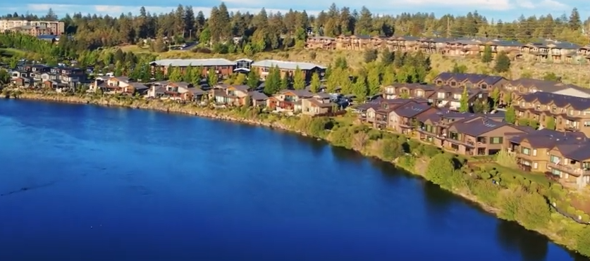
Choosing a neighborhood in Bend is less about finding one universally “best” area and more about deciding which version of Bend you want to live in. Some parts of town are walkable to restaurants and the river. Some put you closer to trail systems and the road to Mt. Bachelor. Others trade nightlife for newer homes, quieter streets, larger lots or easier eastside access.
This guide is built around the questions people actually search before moving to Bend: Which neighborhoods are most walkable? Where is outdoor access easiest? What feels historic versus newer? What are the trade-offs of westside, eastside, northside and southside living?
Important Bend geography note: The City of Bend officially recognizes 13 Neighborhood Districts. Locals also use names such as Northwest Crossing, Discovery West, Downtown, Midtown, the Westside and the Old Mill. Those familiar names can sit inside or overlap the official districts. This guide covers both systems so listings, local conversation and City maps all make sense.
Bend Neighborhoods at a Glance
| Area | General feel | Good fit if you want… | Main trade-off |
|---|---|---|---|
| Old Bend / Downtown | Historic, central, walkable | Restaurants, Drake Park, older homes, short trips | Smaller lots, traffic/events, premium central location |
| River West / Westside | Lively, established, outdoorsy | River access, Galveston/Newport, biking, dining | Busy corridors and strong housing demand |
| Northwest Crossing | Planned, walkable, polished | Town center, parks, trails, neighborhood feel | Newer/planned feel and westside pricing pressure |
| Discovery West | Newer westside development | New construction, open space, west-edge access | Still developing; amenities evolve over time |
| Summit West | Trail-oriented westside | Shevlin access, parks, westside lifestyle | Farther from eastside; wildfire/snow considerations near the edge |
| Century West | Recreation corridor | Century Drive, river, trails, Mt. Bachelor access | Seasonal recreation/event traffic |
| Awbrey Butte | Hillside, quiet, view-oriented | Space, views, privacy, northwest location | Steeper roads, snow/ice, less walkable day to day |
| Southern Crossing / Old Mill | River + mixed-use | Old Mill, concerts, river trail, central access | Event traffic and busier mixed-use environment |
| Orchard District / Midtown | Central, eclectic, changing | Character homes, food carts, easy cross-town access | Patchwork walkability and redevelopment |
| Mountain View | Eastside residential | Medical access, parks, food pods, eastside convenience | Less walkable to downtown |
| Larkspur | Established southeast | Trails, parks, community facilities | Car-dependent in some pockets |
| Old Farm District | Residential south/southeast | Quieter neighborhoods, newer + established mix | Fewer walkable restaurant clusters |
| Southeast Bend | Growing, newer, edge-of-town | Newer housing, open views, south/east access | Longer trip to downtown/westside |
| Boyd Acres | North/northeast, mixed | North-end access, employment/shopping, varied housing | More auto-oriented overall |
| Southwest Bend | Residential southwest | South-side access, quiet pockets, river/park proximity | Less of a single walkable town center |
Bend’s 13 Official Neighborhood Districts
The City of Bend currently recognizes these 13 Neighborhood Districts:
- Awbrey Butte
- Boyd Acres
- Century West
- Larkspur
- Mountain View
- Old Bend
- Old Farm District
- Orchard District
- River West
- Southeast Bend
- Southern Crossing
- Southwest Bend
- Summit West
These are not HOAs. The City describes Neighborhood Districts as community organizations that connect residents, renters, businesses and organizations with local decision-making and land-use information. One official district can contain many subdivisions, HOAs and locally named neighborhoods.
Use the City of Bend Neighborhood District map when you need the exact official boundary for an address.
Best Bend Neighborhoods by Lifestyle
Most walkable to restaurants and nightlife
Start with Old Bend/Downtown, River West, Northwest Crossing and parts of Southern Crossing.
Walkability is block-specific in Bend. A house two blocks from Galveston can feel completely different from one farther up the westside hills even though both get marketed as “Westside.” Map the exact address to your real errands.
Best for trail access
Look hardest at Summit West, Century West, River West and parts of Larkspur/Southeast Bend.
Summit West has strong access toward Shevlin Park and westside trail systems. Shevlin Park itself is a 981-acre regional park with miles of trails around Tumalo Creek. On the east side, the Larkspur Trail runs about 3.9 miles through east Bend and connects parks and Pilot Butte-area routes.
Best for getting toward Mt. Bachelor and the Cascades
Century West and western Summit West put you closest to the main recreation corridors leading toward Century Drive, Phil’s Trail, Cascade Lakes Highway and Mt. Bachelor.
That does not guarantee the shortest real-world drive. Powder mornings, summer weekends and events can change traffic quickly.
Best for a newer-home feel
Look at Discovery West, Southeast Bend, parts of Old Farm and newer pockets of Boyd Acres/Mountain View.
Bend also has heavy infill, so brand-new townhomes can appear inside older districts.
Best for historic Bend character
Old Bend, River West and Orchard District contain many of the older homes, mature trees and street patterns people associate with established Bend.
Best for views and hillside living
Awbrey Butte is the obvious starting point. The trade-off is topography: steeper driveways, winter traction and less practical walkability.
Old Bend: Historic, Central and Truly Walkable
Old Bend sits at the heart of the city and gives you quick access to Downtown, Drake Park, Mirror Pond and the Deschutes River. The City describes it as the south-central Bend business core.
What it feels like:
- Older housing stock and architectural character
- Mature trees and smaller-scale streets
- Walk/bike access to Downtown and Drake Park
- More visitors, pedestrians and event traffic than many residential areas
Best for: people who would rather walk to dinner than have a big yard, downtown workers and anyone drawn to Bend’s older homes.
Trade-offs: less privacy, busy weekends, parking pressure and the maintenance realities that can come with older construction.
River West: The Classic Bend Westside
River West runs along the west side of the Deschutes and is one of Bend’s most recognizable lifestyle areas. When locals casually say “the Westside,” they often mean some combination of River West and nearby westside neighborhoods.
Why people like it: Galveston and Newport dining/coffee, river proximity, biking/walking, established homes and a quick route toward westside recreation.
Best for: people who want restaurants and outdoor access to overlap.
Trade-offs: popular commercial streets get busy and walkability can change dramatically by block.
Northwest Crossing: Planned Walkability + Westside Access
Northwest Crossing — usually NWX — is one of Bend’s best-known master-planned communities. It is not one of the City’s 13 official districts; it sits within Summit West.
NWX combines homes, parks, trails, schools and a compact commercial town center in a way that feels intentionally walkable.
Why people choose it:
- Restaurants, coffee and services in the neighborhood core
- Sidewalks and trail connections
- Parks and community events
- Mix of detached homes, townhomes and other housing types
- Westside access without being directly downtown
Trade-offs: it feels more planned than historic Bend, and current housing prices vary too much to summarize with one evergreen “average.”
Discovery West: Newer Westside Bend
Discovery West sits immediately west of Northwest Crossing and north of Summit High School. Its developer describes a 245-acre neighborhood with diverse housing types, about 40 acres of parks/open space and strong walking/biking connectivity.
Best for: newer construction, modern neighborhood design and direct access to Bend’s western edge.
Trade-offs: it is still evolving, so construction activity, retail and traffic patterns can change as the neighborhood builds out.
Summit West: Parks, Trails and the Western Edge
Summit West is the youngest of Bend’s 13 official districts and includes NWX plus many other neighborhoods along the Shevlin Park Road side of town.
The district naturally connects toward Shevlin Park, one of Bend’s biggest natural-area assets.
Best for: trail runners, cyclists, westside households and people who spend a lot of time outside.
Trade-offs: the western edge puts wildfire preparedness, defensible space and winter driving more squarely into the conversation. Some Summit West pockets are much less walkable than NWX itself.
Century West: Bend’s Recreation Corridor
Century West follows the Century Drive side of Bend and offers some of the city’s easiest access to the westside trail network, Deschutes River and route toward Mt. Bachelor.
Best for: skiers, mountain bikers, river users and people who frequently head west of town.
Trade-offs: Century Drive is a major recreation corridor, so powder mornings, summer weekends and concert periods can be busy.
Awbrey Butte: Views, Hills and Privacy
Awbrey Butte occupies elevated northwest Bend. The defining feature is topography: this is hillside Bend, not flat-grid Bend.
Why people look here: views, larger custom homes in many pockets, quieter streets and northwest positioning close to central Bend.
Best for: people who value privacy and views more than walkability.
Trade-offs: steep streets and driveways matter in winter, and wildfire preparedness can be more relevant in vegetated hillside settings.
Southern Crossing: River, Old Mill and Central Access
Southern Crossing spans the Deschutes River and includes much of the area people associate with the Old Mill District and central river corridor.
Why it works: river trail access, Old Mill shopping/dining, Hayden Homes Amphitheater and a central location between east and west Bend.
Best for: concerts, river recreation and people who want central access without living directly downtown.
Trade-offs: event nights and summer river traffic can make the area feel busy.
Orchard District + Midtown: Central, Eclectic and Changing
The official Orchard District covers east-central Bend. “Midtown” is a common local label for parts of central Bend east/northeast of Downtown around the Greenwood, 3rd/4th Street and nearby corridors.
Why people like it: central location, older homes mixed with infill, food carts/breweries, Pilot Butte access and less of a master-planned feel.
Best for: people who value central positioning and independent businesses.
Trade-offs: sidewalk and walkability quality is inconsistent, and redevelopment is ongoing.
Mountain View: Eastside Convenience
Mountain View is in northeast Bend and includes residential areas around the hospital/medical corridor and eastside services.
Why it works: proximity to St. Charles, eastside shopping, parks and food-cart/taproom options such as On Tap and River’s Place.
Best for: healthcare workers and people who want eastside convenience without needing to be on the Westside every day.
Trade-offs: most of the district is more car-oriented than Old Bend or River West.
Larkspur: Trails + Established Southeast Bend
Larkspur is an established southeast/east-central district with residential neighborhoods, parks and strong north-south trail connectivity.
The Larkspur Trail is the signature amenity: Bend Park & Recreation says it runs about 3.9 miles and connects Larkspur Park, Pilot Butte-area routes and other trail systems.
Best for: urban trail access, parks and central-east convenience.
Trade-offs: commercial walkability varies substantially by pocket.
Old Farm District: Residential South/Southeast Bend
Old Farm covers a broad south/southeast area with established subdivisions, newer housing and a quieter overall character.
Best for: residential streets, yard/garage space and south-side convenience.
Trade-offs: there is no single Old Farm town center, so daily convenience depends heavily on the exact address.
Southeast Bend: Newer Growth + Open Edges
Southeast Bend is one of the places where Bend’s growth is easiest to see, with newer subdivisions and infrastructure extending the southeastern edge.
Best for: newer housing, open high-desert feel and people who spend more time south/east of town.
Trade-offs: longer trips to Downtown, Galveston and westside recreation; nearby retail and roads can change as growth continues.
Boyd Acres: North Bend Variety
Boyd Acres covers a large north/northeast area and has a broad mix of homes, apartments, commercial areas, employment uses and newer development.
Best for: north-end access, trips toward Redmond/airport, shopping/services and varied housing inventory.
Trade-offs: more auto-oriented and less cohesive as a single walkable “village.”
Southwest Bend: Quiet Southside Pockets
Southwest Bend sits between the Deschutes River and Highway 97 on the south side and includes several established residential pockets.
Best for: quieter residential living, south Bend access and households that often head toward Sunriver or Highway 97 destinations.
Trade-offs: like Old Farm, it does not revolve around one obvious commercial center.
What About Downtown Bend?
Downtown is a real and useful local area name but not one of the City’s 13 official Neighborhood Districts. Residential blocks near Downtown generally fall into Old Bend or adjacent districts.
When a listing says “Downtown,” check the exact map. It might mean truly walkable-to-Wall-Street living, or simply “close to downtown.”
What About Midtown?
Midtown is also a widely used local label rather than an official Neighborhood District. Use “Midtown” for lifestyle/search purposes and the City’s official district map for exact boundaries or land-use notices.
Visitors vs. Residents: Different “Best” Neighborhoods
The best place to stay for a weekend is not automatically the best place to live for five years.
Visitors often prioritize: Downtown/Old Bend for walking, River West for restaurants + river access, Old Mill/Southern Crossing for concerts, and Century West for recreation.
Residents may care more about: commute route, snow/ice, grocery access, garage/parking needs, school attendance boundaries, HOA rules, wildfire preparedness and whether the daily walk actually connects somewhere useful.
How to Choose a Bend Neighborhood
Do not pick from a “top 10” list alone. Use this process:
- Decide which side of town you need most often. Highway 97, the river and limited cross-town routes can make short distances feel longer at busy times.
- Map your three most frequent trips. Work, groceries, gym/daycare/school, trailhead — whatever actually matters.
- Visit the exact street at different times. Morning, after-work and weekend conditions can feel very different.
- Walk the block. Sidewalks, hills, traffic speed and trail connections do not show up clearly in listing photos.
- Check HOA documents if applicable. An HOA and a City Neighborhood District are completely different things.
- Verify school boundaries directly. Do not assume a neighborhood name guarantees a specific school.
- Think about wildfire and winter realities. Especially on wooded, hillside and edge-of-city properties.
- Use current listings for pricing. Bend’s market changes too fast for a static guide to give reliable neighborhood averages.
Westside vs. Eastside Bend
Westside advantages
- Easier access toward Mt. Bachelor and major westside trails
- More walkable restaurant clusters in River West/NWX
- River access in several areas
- Strong outdoor-lifestyle identity
Westside trade-offs
- Strong demand
- Recreation/event traffic on key corridors
- Older housing stock in some areas
- Hills and snow in northwest pockets
Eastside advantages
- Medical/employment access
- Growing restaurant and food-cart scene
- More varied housing inventory
- Major shopping/service areas
- Excellent urban trail systems around Larkspur/Pilot Butte
Eastside trade-offs
- Less walkability to Downtown in many neighborhoods
- More car-oriented street patterns in some areas
Neither side is inherently better. The right answer is the one that matches your weekly routine.
Bend Neighborhood FAQ
What are the official neighborhoods in Bend, Oregon?
The City recognizes 13 Neighborhood Districts: Awbrey Butte, Boyd Acres, Century West, Larkspur, Mountain View, Old Bend, Old Farm District, Orchard District, River West, Southeast Bend, Southern Crossing, Southwest Bend and Summit West.
Is Northwest Crossing an official Bend Neighborhood District?
No. Northwest Crossing is a master-planned community within the broader Summit West Neighborhood District.
Is Discovery West part of Bend?
Yes. Discovery West is within Bend city limits, immediately west of Northwest Crossing and north of Summit High School.
Which Bend neighborhood is most walkable?
Old Bend/Downtown is the clearest answer for walking to the largest concentration of restaurants and shops. River West and Northwest Crossing also have very walkable pockets. Exact address matters more than the district name.
Which neighborhoods are best for outdoor access?
Summit West and Century West are excellent for westside trails and Cascade access; River West has river/trail access; Larkspur offers strong urban trail connections on the east side.
Which neighborhoods are closest to Mt. Bachelor?
Century West and western parts of Bend generally provide the most direct route toward Century Drive and Mt. Bachelor. Actual drive time varies with weather and ski traffic.
Where are the historic homes?
Old Bend, River West and parts of Orchard District contain many older homes and established streets, though infill is happening throughout central Bend.
What is the difference between a Neighborhood District and an HOA?
A Neighborhood District is a civic/community organization recognized by the City. An HOA can impose property-specific rules, dues and design requirements. A home can be inside both.
What is the best neighborhood for families?
There is no universal answer. Compare parks, school boundaries, traffic, sidewalks, commute, yard needs and your preferred activities for the exact address rather than relying on a generic “family-friendly” label.
What is the most affordable Bend neighborhood?
There is no reliable evergreen answer. Prices vary by property type and move quickly. Search current listings across several districts instead of relying on an old article naming one side of town “affordable.”
More Moving-to-Bend Resources
- Grocery stores in Bend
- Best restaurants in Bend
- Food trucks in Bend
- Bend coffee shops
- Date night ideas in Bend
- Places to stay in Bend
Updated September 2, 2026. Neighborhood boundaries, development, school attendance areas, roads and businesses change. For an exact official district, use the City of Bend’s current Neighborhood District map. This guide intentionally avoids static home-price and school-rating claims that become inaccurate quickly.